How is the county and/or congressional district data updated?
OutreachSystems receives updated county information twice per year, and OutreachSystems receives updated district information each month. The congressional district information is provided by Capital Canary (formerly KnowWho), a company specializing in congressional contact information. OutreachSystems will attempt to keep your active clients, contacts and training events up to date with the latest information. Neoserra accomplishes this two ways:
- When you edit a client/contact/training event record, then Neoserra will immediately apply the latest county/district data to the record. You will be able to see this instantaneous update on the address tab.
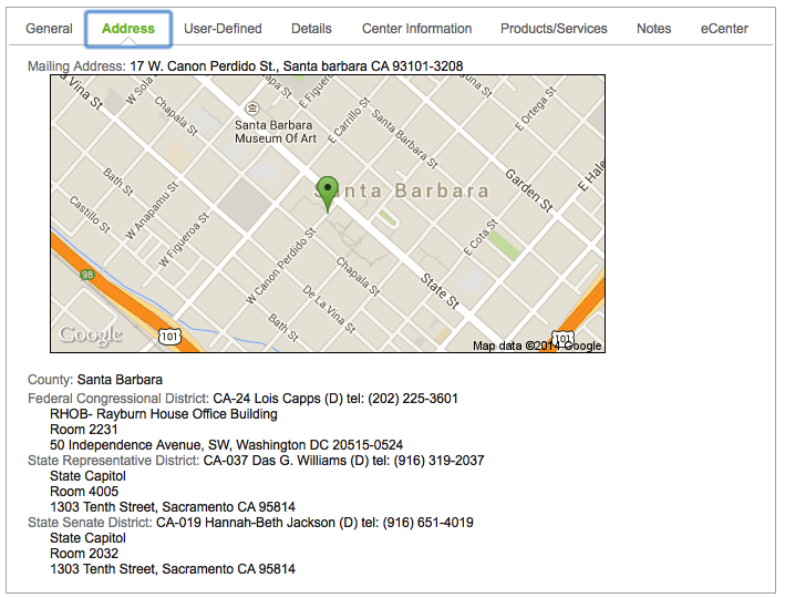
- Upon receipt of an updated county and/or district file, OutreachSystems will update all Neoserra records that have been edited in the last 3 years. Neoserra receives updated information on a monthly basis which means that there may be a small lag between the date the new districts actually take effect and the update applied against your Neoserra database.
If you notice any missing county and/or district data in your records then please verify that the record has a 9-digit ZIP code. Neoserra is dependent upon the complete 9-digit ZIP code in order to ensure proper county/district assignments. Neoserra will automatically validate all addresses in the database as soon as you save the record.
If, for some reason, your client/contact/training record shows a 5-digit ZIP Code, then this means that Neoserra was not able to validate the address. You should either update the address or manually add the 9-digit ZIP code. If you don't know the 9-digit ZIP code then you can ask the client to refer to any junk mail they may have received recently. Most bulk mail will include the complete 9-digit ZIP code. Alternatively, you can visit the USPS Web site to confirm the address status. If you'd like to confirm that it is a non-deliverable address, visit the USPS Web site directly at www.usps.com and, from their home page, select the "Look Up a ZIP Code" service. Enter the address into this service and USPS may return a more detailed error message. Upon entering the 9-digit ZIP code the correct county and/or district data should instantly appear.
Note: You can include the representative information as substitution variables in the emails that you send your clients, as discussed in this FAQ.
Troubleshooting Wrong County Assignment
The title of this section of the FAQ is actually a bit misleading. That's because, 99.9% of the time, an "inaccurate" county assignment turns out to be accurate. One fact that often surprises people is that a single city can be part of more than one county. We ask that before you bring an invalid county assignment to our attention, you first research the possibility that the city may span one or more counties.
The best way to research this is through MapQuest. Why MapQuest? Because it does an excellent job of visually defining county borders.
- Visit www.mapquest.com.
- Enter the address into the left panel.
- Use the sliding zoom bar to zoom out to about zoom level 10.
- At around zoom level 10, you can see the county names in gray as well as a gray dotted line that demarcates the county border.
If, after viewing the address location in relation to county borders, you still believe the county to have been wrongly assigned during Neoserra's auto-synchronization process, please contact us and, if necessary, we can permanently update our third-party table to reflect the correct county.
Want more? Browse our extensive list of Neoserra FAQs.